18.5 km one way
Intermediate (Grade 3)
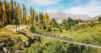
The Twin Rivers Trail starts at the Kawarau Falls Bridge, the trail passes beneath the bridge via an underpass. Directly after the underpass, turn left and head up the hill to Robertson Street. The Twin Rivers Trail takes a left turn off Robertson Street before travelling through the Kawarau Falls Scenic Reserve and down towards the Kawarau River.
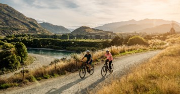
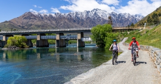
The trail hugs the river's edge, along willow-lined banks of the Kawarau towards the Shotover Delta, where the Kimi-ākau Shotover River joins the Kawarau River from the north. The Twin Rivers Trail heads upstream beside the Kimi-ākau Shotover River towards the Old Lower Shotover Bridge. The climb from river level up to the bridge is a bit of a steep pinch. Restored to its former glory by the Rotary Club of Queenstown, the Old Lower Shotover Bridge offers a safe pedestrian and cyclist dedicated crossing of the river, as well as panoramic views of the surrounding mountain ranges.
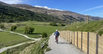
Across the bridge, the trail follows the true left of the Kimi-ākau Shotover River to Old School Road, passing beneath the highway bridge, and continuing around the edges of Shotover Country and Lakes Hayes Estate. There are multiple side trails into both of these suburbs, which are well equipped with toilets, playgrounds and cafes/restaurants.
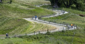
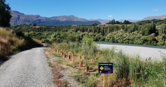
Old MacDonalds Hill is located part way between Shotover Country and Lake Hayes Estate - this is a steady climb so pace yourself on the way up and control your speed down the other side. The views from the elevated points along the trail are gorgeous.
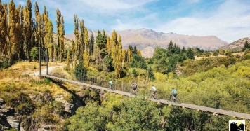
The trail wanders beside the river and is bordered by farm land. At the bottom of "The Middle Climb" you will cross Billie's Bridge before enjoying another steady ascent and descent.
The section of trail between "The Middle Climb" and "Thompson's Hill" winds amongst the buttress-limbs of sprawling willows. This section of trail can be particularly cold in winter, and also occasionally floods when the river is high. Warning signage will be placed during a big flood event.
Thompson's Hill is the longest climb on the Twin Rivers Trail - be prepared for a good few minutes of effort to get to the top, and stay in control of your bike on the descents - there are some switch back corners that are easiest to negotiate at lower speeds.
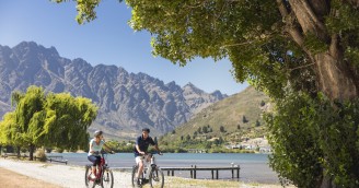
You've most certainly earned the view at the top of Thompson’s hill: sprawling farm land to the north, bordered by Coronet Peak and Big Hill. To the East, the dramatic rock forms of Gibbston. Across the Kawarau River, the Remarkables and Rastus Burn.
Enjoy the easy descent through tranquil pastoral land surrounded by three mountain ranges. The Twin Rivers Trail ends at Morven Ferry Road, intersecting with the Arrow River Bridges Trail. Carry on to Arrowtown or head to Gibbston.
If you need to arrange bike transport back to your home base talk to one of our Transport Official Partners.
what to expect
- A smooth, well maintained gravel surface
- Sign posting and good cell phone reception
- There are 3 longer climbs on the Twin Rivers Trail: Old MacDonalds Hill, The Middle Climb and Thompsons Hill - All of these hills are ridable, but require a decent effort to climb, and riders sometimes prefer to walk these sections. Be sure to control your speed if you are riding down.
- Expect to see evidence of a recent land-slip at the top of the middle climb - there is a safe route across the slip, but consider walking your bike across this section if you don't feel confident to ride it.
- There is occasional flooding along low sections of the Twin Rivers Trail, keep an eye on the website for notifications about trail conditions after heavy rain.
- The Twin Rivers Trail passes through a deer farm between Thompsons Hill and Morven Ferry
- A short section of the Twin Rivers Trail shares Old School Road between the Old Lower Shotover Bridge and Shotover Country - please share the road with care
The Twin Rivers Trail is a Grade 3 (Intermediate) trail. If you are not comfortable riding a Grade 3 trail, try walking it instead or riding one of the Grade 2 sections of the Queenstown Trail.